Headwaters and Louisa
Source and former post office · head of the prong · South Prong mile 15.9 · Plates A1, A15
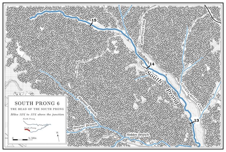
The South Prong heads on the upland about ten miles east of CaboolUSGS GNIS (source of South Prong Jacks Fork; Cabool), distance measured.. Its headwaters are also placed about five miles east of CaboolMDC 2001, PDF 1, 5 (“approximately 5 miles east of Cabool”)., which fits the head of the nameless creek at mile 11.5 better (Chapter 2).
Near the head, where a small Branch. A small creek. The sense is American, on record from 1674 (Chapter 18). Glossary → comes in from the north, is the map point for LouisaUSGS GNIS (Louisa); Jacks Fork Creek Network 2026., a village and post office of 1910 to 1922 (its dates are also given as 1905 to 1923Forte, Postal History, Texas County.). It was named for the wife of Jim Embree, the storekeeper and postmasterO’Brien 1939, 77.. Cabool itself, beyond the head, began in 1882 as a railroad town, named by its promoters, Ralph and Frances Walker, for the capital of Afghanistan. A local legend, current in the 1930s, tells of a chief named Cabool who carried off Tahassie, the daughter of Chief Pomona; when her father brought his warriors after them, the two plunged together over a cliffO’Brien 1939, 22, the only source for the names; her sources for the entry are the Goodspeed History of Texas County (1889), 488, an article by Eaton in the Missouri Historical Review 13, 69, a local informant and the Cabool Enterprise, May 18, 1938. rather than be parted. The name came first, and the story was almost certainly fitted to it afterwardO’Brien 1939, 214, which judged it the most “artificial and obviously ‘ex post facto’” of the local legends in her five counties..