The Atlas
Maps
Click a plate outline on the index map to open that part of the river. On each plate, click a stretch to go to its page.
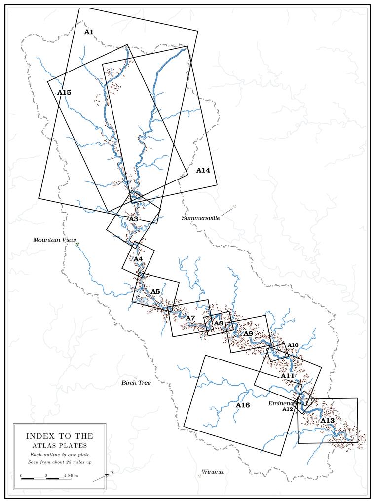
The maps here are web copies, sharp enough to read on a screen. The printed book carries them full size, with the scale bars true.
The atlas plates
- Plate A1 The Prongs
- Plate A14 The North Prong
- Plate A15 The South Prong
- Plate A3 Low Water to Steel Bridge
- Plate A4 Steel Bridge to Muck Forty
- Plate A5 Muck Forty to Rymers
- Plate A7 Rymers to Leatherwood Creek
- Plate A8 Leatherwood Creek to Bay Creek
- Plate A9 Bay Creek to Alley
- Plate A10 Alley Spring
- Plate A11 Alley to Eminence
- Plate A16 Mahans Creek and Delaware
- Plate A12 Eminence
- Plate A13 Eminence to the Mouth
The maps
- Map 1 Explanation
- Map 2 The Jacks Fork Watershed
- Map 3 Index to the Atlas Plates
- Map 4 Rock and Water Underground
- Map 6 Mills, Fords and Roads
- Map 7 Woods, Ties and Rails
- Map 8 Names That Moved
- Map 11 The Gravel River
- Map 12 The River's Fall
- Map 13 The Bluffs
- Map 14 How High It Gets
- Map 15 Names Found Nowhere Else
- Map 16 The Valley in Section
- Map 17 The Gone River
- Map 18 The Family Tree
- Map 19 Woods Then and Now
- Map 20 Where You'll Walk
- Map 21 The Swimming Holes
- Map 22 Sun and Shade
- Map 23 The Enclosed River
- Map 24 Float Times
- Map 25 What the Names Say
- Map 26 The Valley in Relief
- Map 27 Where the Water Comes From
- Figures 21 and 22 Steel Bridge and Blue Spring, 1995–2026
The stretches
Twenty-eight half-page maps of the river at 1:10,000, in the Stretch Guide.