Buxton Hole and the Buxton farm
Pool and old farm · left bank (farm) · about mile 30.0 · Plate A9
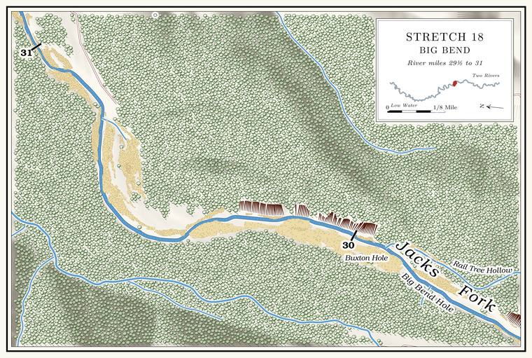
Buxton Hole lies below Rail Tree Hollow, at the end of Buxton Lane, with the old Buxton farm on the left and a Bluff. A cliff along the river, usually on the outside of a bend, where the river has cut sideways into the hill. In this sense the word was first used in North America (Chapter 2; Chapter 18). Glossary → of about 200 feet across the river on the rightmeasured on the flood-mapping terrain (Heimann, Atkinson and High 2025; Map 13), the faces on the right at about miles 30.0 to 30.3.. The story goes that Robert Powell moved onto the farm early in the 1860s, and that Lieutenant Boyd and the militia stopped at the house when Powell’s wife, Julianna, had just given birth to twin girls. The men carried the bed out into the yard with Julianna and the twins in it and burned the cabin. Neighbors took the mother and babies to the Union lines near Rolla, and the twins took pneumoniaLewis 1980, PDF pp. 44, 47 (map), the only source for this telling. and died. In November 1863 Lieutenant John W. Boyd’s patrol, having come to the river by the Leatherwood trail, went ten miles down the Jacks Fork to the Widow McCormick’sOR, vol. 22, pt. 1, 746–47; see Chapter 6., and two other tellingssee Chapter 6. of a Jacks Fork twins story are in Chapter 6.
William Buxton lived on the farm in the 1880s. In the winter of 1886, by one account, he gigged a ten-pound Jack salmon. The Ozark name for the walleye, a fish not collected in the Jacks Fork since 1980 (Chapter 9; Chapter 16). Glossary →Lewis 1980, PDF p. 44, the only source; see Chapter 19. near the farm (Chapter 19). Jack salmon was the Ozark name for the walleyesee Chapter 9., a fish not collected in the Jacks Fork since 1980MDC 2001; see Chapter 16. (Chapter 16). In the Current, walleye spend the day in Pool. A deep, slow stretch of river between riffles (Chapter 16). Glossary → twelve feet deep or more, where boulders or sunken logs break up the Bottom. The flat land along a river or creek, built of its deposits and open to its floods. In the 1920s the bottoms near Eminence averaged about a quarter of a mile wide (Chapter 2; Chapter 5). Glossary →, and move into shallower water at night. Grown walleye usually weigh from half a pound to about eight pounds, though bigger onesMDC, “Walleye.” turn up.
The last miles to Alley
Shallows and branch · about miles 30.0 to 31.3 · Plate A9
Below Buxton Hole the river runs north-northeast toward Alley through the widest and shallowestPlate A9; MDC 2003; see Chapter 20. water of the stretch. An unnamed Branch. A small creek. The sense is American, on record from 1674 (Chapter 18). Glossary → of a little more than half a square mile comes in on the left at about mile 31.3Jacks Fork Creek Network 2026 (31.27, left; 0.58 sq mi).. In 1998 and 1999, about a mile and a quarter above Alley Spring, the river ran 5 to 25 meters wide, with pools more than 2 meters deep common between the Riffle. A fast, shallow, rocky stretch between pools. The riffles are the gardens of the riverbed: in July a square meter of riffle produced more than six times as much as a square meter of pool (Chapter 16). Glossary →, and chambersWhitledge and Rabeni 2000, 166; see Chapter 16. set on its bed measured how much the riffles and pools produced (Chapter 16). On Highway 106, about three-quarters of a mile west of Alley Spring, a road cut shows the contact between the Gasconade Dolomite and the Roubidoux FormationThornberry-Ehrlich 2016, 15 (1.2 km, citing Lowell and others 2010). above it.