Part Five
The River Mile by Mile
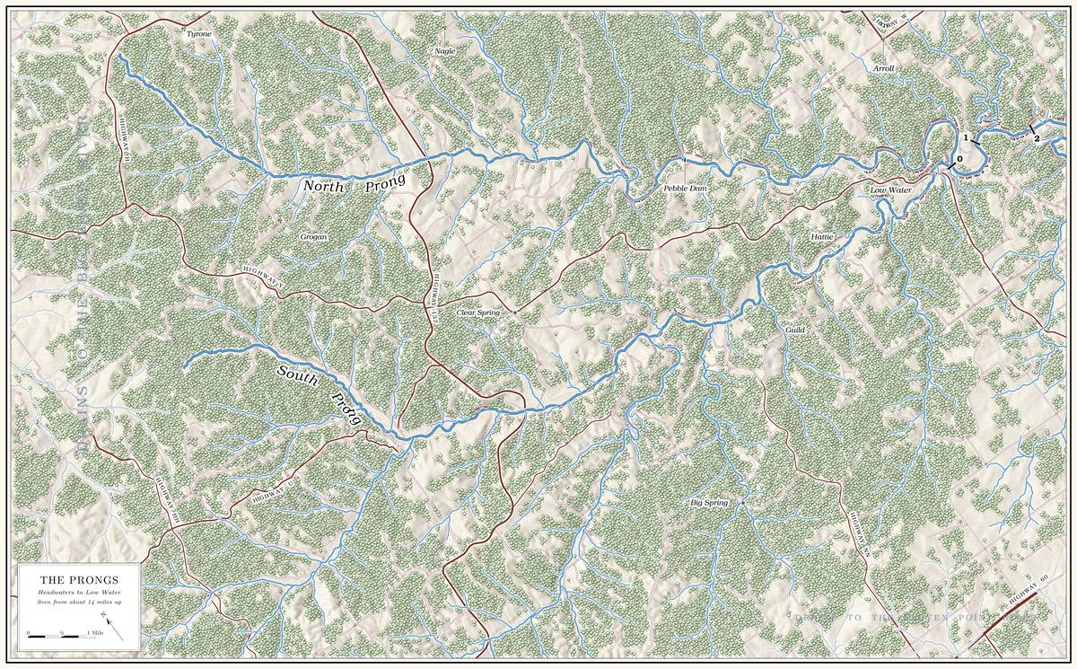
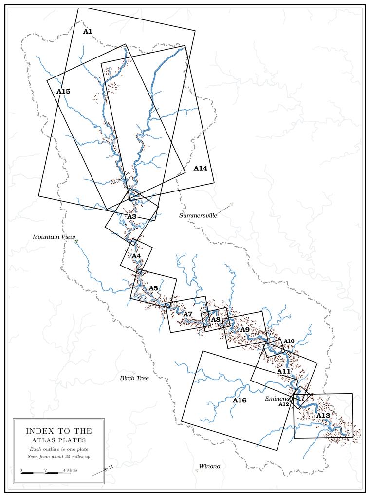
- Reach A The North Prong
From the headwaters to the Prongs · North Prong miles 17.0 to 0 · Plates A1 and A14 - Reach B The South Prong
From the headwaters to the Highway Y bridge · South Prong miles 15.9 to about 0.4 · Plates A1 and A15 - Reach C Low Water to Steel Bridge
From the junction of the prongs to the Highway 17 bridge · miles 0 to 7.0 · Plate A3 - Reach D Steel Bridge to Muck Forty
From the Highway 17 bridge to Muck Forty Hole · miles 7.0 to 11.0 · Plate A4 - Reach E Muck Forty to Rymers
From Muck Forty Hole to the Rymers landing · miles 11.0 to 16.5 · Plate A5 - Reach F Rymers to Bay Creek
From the Rymers landing to the mouth of Bay Creek · miles 16.5 to 25.9 · Plates A7, A8 and A9 - Reach G Bay Creek to Alley
From the mouth of Bay Creek to the head of the Alley Spring Campground · miles 25.9 to 31.3 · Plate A9 - Reach H Alley
From the campground river front to McCormack Bay · miles 31.3 to 33.0 · Plate A10 - Reach I Alley to Eminence
From McCormack Bay to the head of the Eminence riverfront · miles 33.0 to 38.0 · Plates A11 and A16 - Reach J Eminence to the Mouth
From the head of the Eminence riverfront to the Current River · miles 38.0 to 46.2 · Plates A12 and A13